
Platform
Company
Resources
Blog
September 2025 Product Release
September Release: Better Control, Deeper Insights, and Smarter Workflows
Construction teams are only as good as the tools they’re given. And in this release, we’re giving them more control, richer insights, and smarter ways to work across design, planning, and reporting. From streamlined design management to site-wide measurements from drone maps, every feature this month is built with one goal: Clarity at every step of construction.
Here’s what’s new:
1. Measurement Tools for Drone Captures
For: Owners, Estimators, Site Engineers, and QA teams
Our new measurement tools transform drone captures into decision-ready data that teams can trust for planning and execution — especially valuable for large and linear projects like energy infrastructure, airports, or roadways.
With Track3D, drone surveys deliver more than photos. Teams can instantly measure stockpiles, slopes, lengths, and areas while overlaying design files for logistics and QC. These tools cut hours of manual survey work, reduce disputes over quantities, improve safety with slope checks, and build owner confidence by turning aerial captures into transparent, shareable progress data.
Now you can measure:
- Stockpile volume: Quickly calculate how much material has been moved or remains on site
- Cross-section profile: Instantly see elevation or slope changes along any line
- Linear measurements: Measure distances like fences, roads, or pipes directly on the map
- Area measurements: Calculate surface area for excavation, paving or laydown zones
These tools are enabled only on drone-captured orthomaps and built with accuracy in mind.
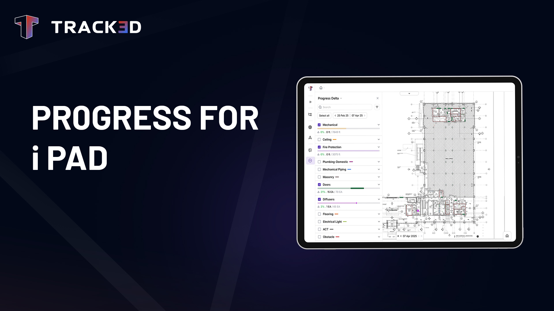
2. HD Downloadable Progress Reports
For: Field teams, Project Managers, Superintendents
Progress data is no good if it stays locked inside a platform. That’s why we now let you download high-resolution printable reports directly from the Progress Details page.
Now you can:
- Export reports in Arch A, Arch B, Arch C, or Arch D sizes
- Choose landscape or portrait orientation
- Include multiple progress categories in a single report
Superintendents can use them foreman meetings, pin progress maps on trailer walls or take them on walkthroughs. This feature was built for the real field—not just the screen.
Ready to See These Features in Action?
Request a demo to explore how September’s updates make Track3D smarter—and your site workflows smoother.
subscribe to our blog
- Benefits
See the advantage of comprehensive and unified site documentation with Track3D
Blog This release focuses on giving enterprise teams the centralized
Blog If you’ve ever watched a superintendent frantically scribble notes
Blog Construction teams rely on multiple systems to manage designs,