When you’re managing a large-scale construction project, keeping site data accurate and up to date can feel like chasing a moving target. Between multiple subcontractors, shifting timelines, and terabytes of visual data, reality documentation often becomes the bottleneck, rather than the backbone of your project workflow.
But it doesn’t have to be that way.
With the right processes and consistency, reality documentation can transform into your team’s single source of truth, helping you track progress, reduce rework, and make faster, data-backed decisions.
This guide breaks down practical tips for effective reality documentation on large-scale projects, the common pitfalls to avoid, and a look at what’s next for 2025 and beyond.
What is Reality Documentation (Why it Matters)
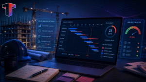
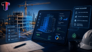
Reality documentation is the process of capturing, organizing, and managing as-built site data throughout the project lifecycle.
It involves technologies like laser scanning, drones, photogrammetry, LiDAR, and 360° imagery all working together to build a consistent, spatially accurate record of what’s happening on-site.
For large-scale projects, this reality data becomes crucial for:
- Monitoring progress against design models (BIM).
- Verifying work quality and dimensions.
- Coordinating between multiple teams and stakeholders.
- Reducing change orders and rework.
In short, reality documentation bridges the gap between field reality and design intent, something every complex project needs to master.
5 Best Practices for Effective Reality Capture on Large-Scale Projects
1. Plan your capture routes and frequency
Walks shouldn’t be random; they should follow a defined route that mirrors the project’s layout and milestones.
Set a consistent capture schedule (daily, weekly, or phase-based) to compare progress over time easily.
Align capture frequency with key construction activities—higher frequency during active phases means fewer surprises later.
2. Keep Capture Angles and Paths Consistent
Whether you’re using a 360° camera, drone, or phone, consistency matters more than volume.
Try and capture from the same spots and angles each time—this makes it easier to identify changes, detect delays, and validate completed work. You can use visual markers or predefined waypoints to help capture teams repeat paths accurately.
3. Use 360 Degree Video or Photo Capture for Complete Coverage
Large projects demand more than handheld photos.
360 degree capture tools provide a full visual record in less time, eliminating blind spots and reducing the need for multiple site visits. Capture while walking naturally through the site, modern AI tools can automatically map captures to your floor plans.
4. Capture in Good Lighting and Safe Conditions
Lighting, dust, and motion all affect data quality.
Make sure captures happen during daylight or with adequate lighting and ensure clear visibility of key elements like walls, slabs, and MEP installations.
5. Cover Critical Areas More Frequently
Focus extra attention on areas with rapid activity or complex coordination, such as MEP Zones, facade works or structural transitions.
Capturing these areas regularly ensures accurate documentation and high-risk, high-value tasks.
Future of Reality Documentation (2025 and Beyond)
Reality documentation is rapidly evolving, and large-scale projects are leading the way. Expect to see:
- Autonomous capture in action: Reality capture won’t rely on humans alone. Robotic dogs, drones, and other autonomous systems will soon handle routine site walkthroughs, collecting consistent visuals with precision while teams focus on insights and decisions.
- AI-assisted processing: Automating capture recognition, coverage checks, and progress tracking.
- Cloud-native collaboration: Instant access to scans and progress data from anywhere.
- Integration with digital twins: Turning static records into dynamic, data-rich environments.
The future isn’t just about capturing reality; it’s about analyzing, comparing, and acting on it to make construction smarter and more predictable.
Conclusion
Your superintendent already walks the site every week. Your Project Manager already reviews progress. Your General Contractor already coordinates trades. Reality capture just makes all of that work more reliable and useful for every decision that comes after. Reality capture is key to that.
When you capture consistently, you stop relying on memory, outdated drawings, and assumptions. Every site walk becomes a permanent record your whole team can go back to, measure from, and act on. That is what keeps large scale projects moving without the costly surprises.
The teams that get the most out of reality capture are the ones with the most consistent process. Same route, same timing, same coverage every single week.
So start simple. Pick your route, set your schedule, and capture every week. The data will do the rest.
subscribe to our blog
- Benefits