There is a category of construction space that has always been difficult to document well: high ceilings, tight overhead systems, mixed lighting, and conditions that get concealed before anyone can get a camera close enough to see them clearly. Walking with a 360 camera gets you most of the way there. But most of the way is not the same as a complete record. Track3D’s aerial 360 capture with the DJI Avata 360 covers the rest: rugged enough to fly close in tight spaces, with the sensor quality to hold detail even when the light gets dim.
Key Takeaways
- Ground-level 360 capture sees overhead conditions only from below, at a poor angle, often after the window to document them has closed.
- The DJI Avata 360 flies a full 360 camera through high-ceiling spaces, capturing the complete sphere in a single pass, even in low-light environments.
- Its structural prop guards let it work close to walls, overhead systems, and equipment without the caution a standard drone requires.
- The footage feeds the same Reality Intelligence workflow that ground captures already use.
The Conditions That Disappear Before Anyone Documents Them
Here is a situation most field engineers have lived through. Overhead MEP goes in. The trade partner finishes rough-in on schedule. The ceiling grid follows shortly after. By the time anyone thinks to verify what the overhead conditions actually look like, the ceiling grid has made the question harder to answer.
The cable tray routing is still up there. The sprinkler mains are still there. The fireproofing on the structural steel is still there. But the angle to see them clearly is gone. What the 360 camera captured from the floor is the underside, squinting upward, which tells you the work happened but not much about how it was done.
This is not rare. It plays out on most projects with meaningful overhead infrastructure: data centers where stacked cable trays and busways run above server halls, stadiums and arenas where roof structure and catwalks are part of what owners need to verify, and distribution centers where ductwork and electrical trays go in at height before the ceiling system closes them off. These are the conditions that get concealed first. They are also the conditions that come back as disputes later, because no one documented them head-on while there was still a clear view.
Ground-level capture was not built to solve this. Flying capture is.
What It Actually Costs to Leave Overhead Conditions Undocumented
A field engineer on the floor cannot verify whether fireproofing on structural steel 30 feet above is evenly applied. Cannot confirm that overhead MEP rough-in matches what the coordination model shows. Cannot document the sprinkler main routing in the window between installation and ceiling grid. The verification gap is immediate. The cost of that gap tends to show up later.
In construction, the cost of a problem tracks closely with when it gets found. Overhead MEP caught during rough-in costs a trade partner a few hours. Found after finishes are installed, it costs everyone: rework, delays, and a dispute over what the site looked like on a date that is now months in the past.
Documentation gaps are where those disputes live. And on most complex projects, the biggest gaps are directly overhead.
“The work that gets concealed first is almost always the work that generates disputes last. Overhead rough-in, fireproofing on steel, the conditions behind finishes: these are the items where owners want verification and where undocumented conditions come back as claims.” This pattern holds across data centers, stadiums, and high-bay industrial projects.
Built to Fly Where It’s Complicated
Not every overhead space is straightforward to fly. Tight mechanical rooms, dense overhead systems, areas where bright bays sit next to genuinely dim corridors: these are the environments where documentation matters most.
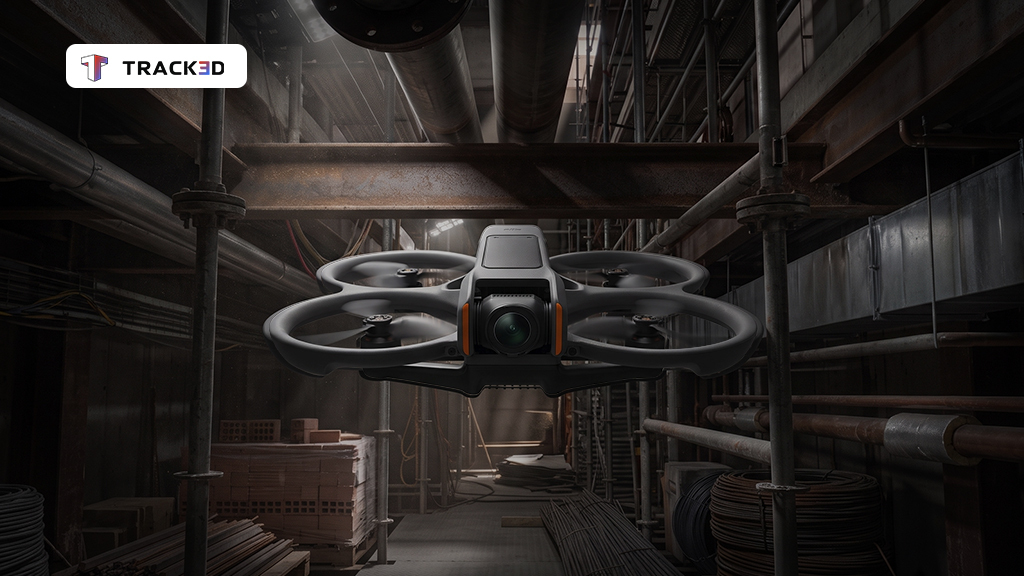
The DJI Avata 360 is built around those conditions. Its integrated propeller guards are designed for close-in work, letting the operator fly near walls, overhead systems, and equipment with more confidence, reducing the hesitation that comes with flying close in a constrained space. On an active job site where the overhead environment is unpredictable, that ruggedness is not a nice-to-have.
Choose the Avata 360 for rugged, close-in work in tight spaces where prop guards help, where you want the option to double as a standard drone, and where lighting ranges from bright to low -but not dark.
Its dual 1-inch-class sensors record 8K HDR 360, which means it holds detail in the kind of mixed lighting most construction interiors actually have: bright areas next to dim ones, daylit zones next to shaded overhead systems. Where smaller camera sensors start to lose detail in the dimmer areas, the Avata 360 keeps capturing. A high-bay distribution center and a dim mechanical room overhead can both produce usable footage in the same flight.
When a straight, forward-facing shot is all that is needed, the Avata 360 switches into Single-Lens mode and records standard flat 4K video, so it doubles as a conventional drone without needing a second airframe on site.
The workflow is simple. The Avata 360 moves through the space capturing the full sphere continuously, no aiming mid-flight, nothing missed because the operator had to commit to an angle before getting close enough to see clearly. When it lands, the operator reviews the footage and pulls exactly what is needed: a close-up on a specific connection, a wide shot of the entire overhead system, a tracking shot along a cable tray run. All of it is in one clip, selected on the ground after the flight is done. That footage then goes directly into the same Reality Intelligence platform as ground-level 360 walks, same interface, same documentation layer, navigable alongside everything else the team has already captured.
One site visit covers overhead conditions and floor-level systems in one or two flights, depending on the height and complexity of the space. The goal is leaving with a complete record, not booking a second visit for the overhead conditions that were out of reach the first time. And for the spaces a person genuinely should not enter an active shaft, a restricted zone, an area where sending someone on a lift introduces real scheduling or safety friction; the Avata 360 goes in instead. Every pixel it captures is seen head-on, not squinted from the floor below.
Where This Makes the Most Difference
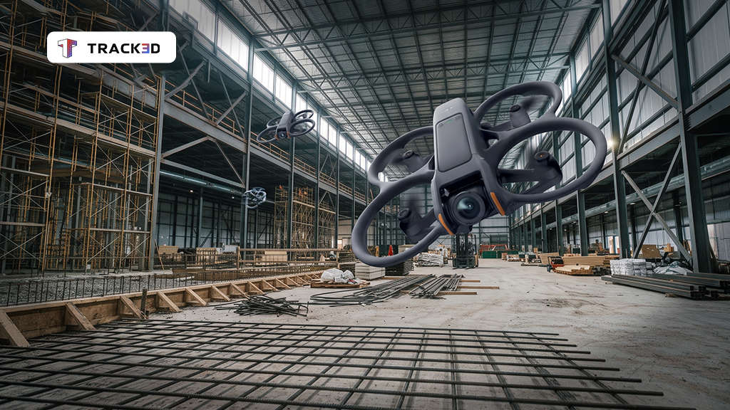
Aerial 360 capture is built for interior spaces where the critical conditions live above the floor and where those conditions get concealed before finishes go in. The Avata 360 is best suited to tight, close-in spaces with ceiling heights of roughly 15 feet or higher, where its prop guards let it work safely near walls, ductwork, and other obstructions that a standard drone can’t approach.
Data centers and server halls. Overhead cable trays, containment, and busway in high-bay rooms. Stacked MEP that is nearly impossible to verify from floor level. These are among the highest-value conditions to document before finishes close them off, and they are also among the hardest to see clearly without being at height.
Stadiums, arenas, and hangars. Roof structure, catwalks, and long-span conditions that have no practical documentation path without lifting equipment, and lifting equipment on an active site introduces its own scheduling friction. A single flight gets what would otherwise take a full lift of mobilization.
Distribution centers and industrial facilities. High-bay spaces where ductwork, piping, and electrical cable trays go well above floor level before the ceiling system closes everything off.
Structural steel at height. Beams, joists, bracing, and bolted or welded connections. Fireproofing applied at height and difficult to assess clearly from below.
Fire protection at ceiling. Sprinkler mains and branch lines in the window between installation and ceiling grid installation.
Restricted or unsafe access. Active floors, shafts, and zones where the safer choice is putting the camera in rather than the person.
What a Complete Overhead Record Actually Changes
The value of documenting what was previously unreachable is not primarily about having more footage. It is about what that footage changes downstream.
A complete aerial record of overhead conditions, timestamped and navigable, changes the terms of any conversation about what the site looked like on a given date. Overhead rough-in and fireproofing on steel are among the most common sources of post-construction disputes. Documentation does not eliminate those conversations. It determines how quickly they end.
It reduces return trips. One or two flights per site visit covers overhead and floor-level conditions together rather than scheduling a separate day for each. Documentation gets more complete without taking more time.
It gives owners a real answer. When an owner asks whether overhead MEP matches the coordination model, the answer comes from a head-on capture at height, not from a floor-level angle that leaves the question open.
It extends the site’s record into spaces that previously had none. For project teams building a record that needs to stay credible over the life of the asset, aerial capture fills the gap that ground walks have always left behind. This is where Track3D brings both halves together. Ground-level 360 walks and aerial 360 capture feed the same Reality Intelligence layer, giving the full picture from floor to ceiling, before finishes, across the full volume of the space.
See What the Overhead Conditions Actually Look Like
Overhead MEP rough-in, structural connections at height, systems behind finishes: these are what owners need on record, and they are what ground-level capture has always seen from the wrong angle.
Aerial 360 capture with the DJI Avata 360 brings those conditions into the same Reality Intelligence record your team already uses. Close-in, robust, and capable in the mixed-light environments where construction actually happens.
Book a demo to see aerial 360 capture in action →
Frequently Asked Questions
What is aerial 360 capture in construction?
Aerial 360 capture uses a drone carrying a 360 camera to document interior construction conditions at height, including overhead MEP, structural steel, and high-ceiling environments that ground-level capture cannot reach with the same quality or angle.
How does the DJI Avata 360 handle low-light conditions indoors?
Its dual 1-inch-class sensors record 8K HDR 360, which holds detail across mixed lighting conditions better than smaller camera sensors. It performs well in environments where bright areas sit next to dim ones. Very dark spaces without any ambient light remain a limitation, as the Avata 360 does not carry an onboard light.
How is aerial 360 capture different from standard construction drone inspection?
Standard drone inspection uses a directional camera and requires the operator to aim at specific conditions during flight. Aerial 360 capture records the full sphere continuously, so shot selection happens after the flight from the complete footage rather than during it.
Does the footage integrate with existing construction workflows?
Yes. Aerial 360 capture in Track3D feeds the same Reality Intelligence workflow as ground-level captures, so the documentation layer is consistent and navigable alongside existing site records.
What types of construction projects benefit most from aerial 360 capture?
Projects with significant overhead infrastructure and high-ceiling environments, above roughly 15 feet, see the clearest benefit: data centers, stadiums, arenas, distribution centers, hangars, and any project where overhead MEP, structural steel, or fire protection systems need to be documented before finishes conceal them.