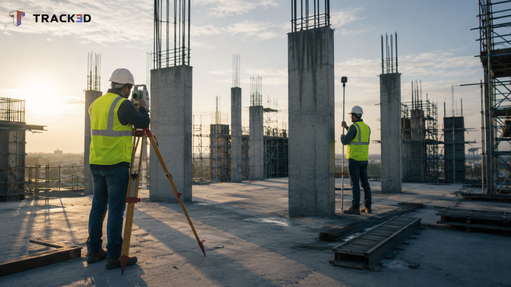
A survey crew sets up a total station at 6 AM to re-shoot control points on a five-story building. A column on the third floor landed four inches off the grid line the drawings called for. Now the general contractor needs an answer before the concrete crew arrives.
As per NIST’s interoperability cost study, poor data hand off carries a real cost for owners. That gap shows up across design, construction, and operations alike. It runs to nearly three percent of the annual value of construction put in place each year. A misplaced column caught late is a small, visible version of that same larger problem.
Key Takeaways
A construction survey covers three distinct jobs. It establishes control, lays out the work, and confirms as-built conditions once construction is in the ground.
Traditional survey workflows rely on total stations and GPS crews that document a single point in time. Drift between the site and the plan often goes unnoticed until it becomes expensive.
According to CII’s bench marking research, field rework tied to layout and coordination gaps runs above three percent of construction-phase cost.
Reality capture tools like terrestrial laser scanning and photogrammetry change what a single survey visit produces. Instead of a handful of shot points, a crew leaves with a complete, measurable record.
Capturing the site throughout the job, not just once, closes the gap between what a survey confirms and what a crew actually builds.
Project managers and superintendents get a current, verified baseline instead of waiting on the next scheduled survey.
What Is a Construction Survey?
A construction survey is the set of measurements a project relies on to confirm where everything sits, on paper and in the ground. Ask a superintendent what a construction site survey covers, and the answer usually starts before construction even begins.
Every construction process opens with a boundary survey. That survey confirms the property boundaries against what’s recorded on the deed, sometimes alongside a topographic survey map of the existing grades.
A licensed surveyor then sets benchmarks and control points as a reference point for horizontal and vertical control across the site. That holds whether the project sits on open land or ties into an existing building.
The next job is layout, marking exact locations for footings, columns, and utilities before a crew breaks ground. This step looks a little different across types of construction, but every layout survey ties back to the same control points set earlier.
The final job is the as-built survey, completed once construction work goes in. A team compares existing site conditions against the original designs and plans. These built surveys become the record for owners, general contractors, and subcontractors alike. Inspections, pay applications, and disputes all eventually call for proof of what’s really in the ground.
The Traditional Construction Survey Workflow and Where It Breaks Down
A traditional construction survey runs on a total station or RTK GPS unit. Two-person crews walk the site, shooting individual points one at a time. That surveying process is precise, but it only captures the site as it looked during that one visit.
A crew installs a wall, and the survey that would have caught a location error already happened two weeks earlier. Nobody re-verifies the work until the next scheduled survey. Sometimes a problem surfaces on its own first, during an inspection.
Scheduling a survey crew back onto an active site takes time, since a general contractor has to coordinate around trades already working the area. On a tight job, the follow-up inspection gets pushed back, and the gap between the plan and the site grows a little wider each day it waits.
As per CII’s Field Rework Index research, field rework carries a real cost on heavy industrial projects. That cost runs above three percent of construction-phase cost, and layout errors nobody caught in time make up a meaningful share of it.
What Reality Capture Adds to Construction Surveying
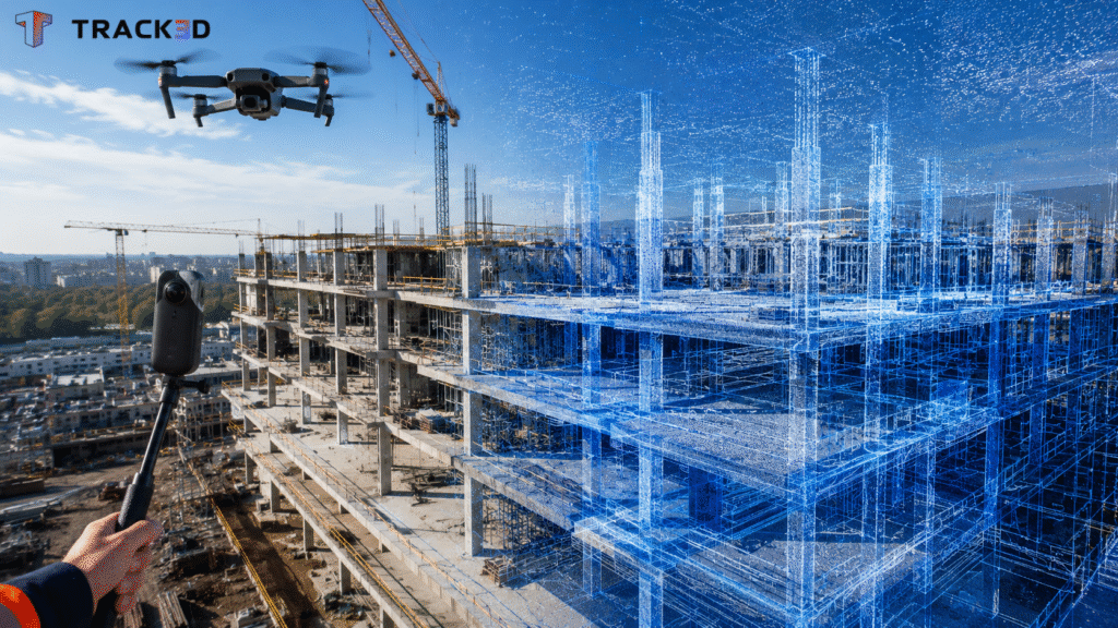
Reality capture replaces a handful of shot points with a complete, measurable record of the site. A terrestrial laser scanning unit captures millions of 3D measurements in a single pass. That point cloud is accurate enough to check column placement, wall alignment, or clearances against the model.
Photogrammetry achieves something similar from overlapping photographs instead of laser returns. A drone can cover a roof, a facade, or an entire site in the time a ground crew needs to survey one wing. Both methods turn a survey from a single data point into a full 3D dataset. A project manager can measure that dataset against the model months later.
On similar construction projects, more construction surveyors now pair a licensed crew with this kind of capture. A superintendent can pull up last week’s capture and measure it against the model. That catches a problem while it’s still cheap to fix, not after a wall closes over it.
From Capture to Verified As-Built: Closing the Survey Loop
The real value shows up when a team captures the site throughout the job, not just once at closeout. A single as-built survey confirms the site only on the day the crew shoots it. Every day after, the jobsite keeps changing, and repeated capture keeps that record from going stale between visits.
At Rycon Construction, a QC walk using ongoing site capture caught misplaced columns. Those columns had already passed submittal review and subcontractor inspection, and catching the error before drywall went up prevented $75,000 in rework on the project.
Capturing the data is only half the job, though. Turning it into a verified answer instead of just more footage is what separates Reality Capture from Reality Intelligence. That distinction is exactly what closes the loop between a survey and what a crew actually built.
What This Means for Project Managers and General Contractors
As per the Bureau of Labor Statistics, the median surveyor earned just over $72,000 in 2024. The agency also projects four percent growth in demand for the role through 2034. Skilled survey capacity is not getting easier to find, so every hour a crew spends on a repeat visit costs more than it used to.
That’s where pairing traditional survey control with reality capture pays off fastest. A drone flight feeds Track3D’s measurement tools, which turn cut and fill quantities, grading cross-sections, and stockpile volumes into numbers. Those numbers let a project manager check the work without walking the site again.
A superintendent who checks a live capture against the plan gains the same confidence a scheduled survey used to take a week to deliver. That confidence now arrives the same day the work goes in.
Closing the Gap Between the Survey and the Site
A survey confirms one version of the site, and what a crew actually builds can end up being another. That gap drives rework, disputed pay applications, and repeat site visits. Track3D combines 360 capture, drone footage, and laser scan data with a project’s BIM plan in one place. A team can then check site conditions against the model without waiting on the next scheduled survey. Explore how Track3D fits into an existing survey workflow on your own project.
Frequently Asked Questions
Q1. What is a construction site survey?
A construction site survey is the set of measurements taken before, during, and after construction. It confirms boundaries, control points, and built conditions, and it typically includes a control and layout survey plus an as-built survey once construction wraps up.
Q2. What is a construction survey used for?
A construction survey establishes where a project’s boundaries, utilities, and structures actually sit relative to the design. Owners use it to confirm what they’re paying for. General contractors use it to verify layout before a crew builds on it. Both sides rely on it to resolve disputes when built conditions and drawings disagree.
Q3. How does reality capture improve construction surveying?
Reality capture adds ongoing, measurable documentation between scheduled surveys. A project team no longer has to rely on a single site visit’s shot points. Instead, the team checks a laser scan or drone capture against the model at any point in the schedule. That catches a layout or coordination issue before it turns into a rework cost.