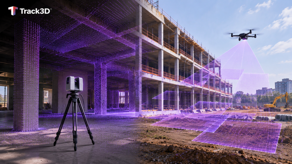
LiDAR measures distance directly with laser pulses. Photogrammetry builds 3D data from overlapping photos. That difference sits at the core of the LiDAR vs photogrammetry decision, and it plays out differently on a building project than on open terrain. LiDAR is the stronger choice for dense geometry, existing conditions and as-built checks. Photogrammetry is the stronger choice for site overviews, earthwork volumes and exterior records with color and texture. Most comparisons are written for terrain mapping. This guide works through the question the way a project team faces it, phase by phase, indoors and out.
How Each Method Works
LiDAR
LiDAR stands for light detection and ranging. NOAA defines lidar as a remote sensing method that uses light in the form of a pulsed laser to measure ranges. It is an active instrument, which means it sends out its own light pulse and measures the light reflected back, as NASA Earthdata explains. Each return becomes a point in 3D space. On a building, a scanner captures the scene from several positions to reach hidden areas, and those scans are registered into one combined point cloud, according to the GSA BIM Guide for 3D Imaging. Because LiDAR supplies its own light, it works in low light. The LiDAR glossary entry covers the core terms in more depth.
Photogrammetry
Photogrammetry measures from photos. A camera captures many overlapping images of the same area from different positions, and software calculates 3D positions from the features those images share. The output can be a point cloud, a surface model or an orthomosaic. Aerial photogrammetry captures from a drone, while close-range photogrammetry works from the ground. Results depend on good light, enough overlap and surfaces with visible texture. The photogrammetry glossary entry explains the terms behind the process.
The short version comes down to direct versus indirect. LiDAR measures distance. Photogrammetry calculates it from pictures.
Side by Side
The table below compares photogrammetry vs LiDAR on the points that decide a construction capture. It leaves out accuracy figures on purpose, because accuracy is tested for each finished dataset rather than fixed by the method. The FAQ below covers how that testing works.
| Topic | LiDAR | Photogrammetry |
| How it measures | Laser pulses return distance directly | Software builds 3D data from overlapping photos |
| Strengths | Direct measurement, works in low light, can see through gaps in vegetation | Color and texture, lower equipment cost, good for surfaces |
| Limits | Heavier equipment, large files, specialist processing | Needs good light and overlap, weaker on featureless surfaces |
| Best on a project for | Existing conditions, dense geometry, as-built checks | Site overviews, volumes, exterior progress records |
Read the table as a starting point rather than a verdict. The right answer shifts as the building rises, because the site itself changes what each method can see.
Which Fits Which Phase
Every reality capture method answers a specific kind of question. A building changes shape every few weeks, and the right capture method changes with it. Match the method to the decision the team needs to make in that phase.
Site Work and Earthwork
Open ground and large areas suit drone photogrammetry. Drone images produce an orthomosaic that teams use for stockpile volumes, cut and fill, and grading checks against design. Accuracy at this stage depends on ground control points and image overlap. Drone LiDAR earns its place when the site still carries trees or brush. USGS work with airborne lidar shows it can characterize bare earth under a variety of vegetation types, which photos of a canopy cannot. This is where the drone LiDAR vs photogrammetry question comes up most often. Once the site is cleared, that ground-reaching advantage matters less. The guide to photogrammetry in construction progress monitoring goes deeper on aerial capture through the early phases.
Structure
Steel, concrete and formwork create dense geometry with many hidden faces. Terrestrial LiDAR suits this phase, and the GSA guide notes that scenes need scanning from several positions to capture occluded regions and minimize missing data. The result supports as-built checks against the model before the next trade builds on top. Photogrammetry still records exterior progress and site overviews as the frame goes up.
Interior Rough-In
Once the building closes in, daylight drops and walls fill with MEP. LiDAR works in low light, and the GSA guide lists documenting MEP and above-ceiling conditions among the uses of 3D imaging. That gives the team a measured record of conduit, duct and pipe runs before drywall and ceilings cover them. Photogrammetry needs good light and visible texture, and enclosed interiors often offer neither.
Finishes
Finish stages bring blank painted walls, glass and polished floors. Featureless surfaces give photogrammetry little to match. Laser scanning has its own limits here, because the GSA guide flags specular surfaces such as polished surfaces and windows, along with dark matte surfaces, as challenges for 3D imaging. Plan captures around these surfaces whichever method the team uses, and target LiDAR at the checks where measured geometry matters.
Closeout
Closeout needs a record the owner can use for years. A 3D laser scanning pass delivers a measured point cloud of existing conditions, and the GSA guide lists as-builts, inventory and maintenance among the uses of that data. In one GSA renovation case, the design team used the point cloud and 3D model from earlier scanning. Scanners usually capture color through an integrated or externally mounted camera, so the owner gets geometry and appearance together. Tie every capture to a location and a date the facilities team can find on its own.
Decision Table by Phase
| Phase | Lead method | Why |
| Site work and earthwork | Drone photogrammetry | Large open areas, volumes, color orthomosaic |
| Site work with vegetation | Drone LiDAR | Reaches bare earth under vegetation |
| Structure | Terrestrial LiDAR | Dense geometry and as-built checks |
| Interior rough-in | LiDAR | Low light and MEP before it is covered |
| Finishes | Imagery, with LiDAR for targeted checks | Featureless and reflective surfaces |
| Closeout | LiDAR paired with imagery | Measured existing conditions for the owner |
Cost, Time and Skill
Neither method has a fixed price. Four factors drive what a capture costs, and they weigh differently on each side.
Equipment. Photogrammetry runs on cameras and camera drones, which carry a lower equipment cost than LiDAR. LiDAR equipment is heavier and produces larger files. The GSA guide itself notes that photogrammetry or traditional surveying can be the better or more cost-effective choice on some projects.
Field time. Drone flights in the US fall under FAA Part 107, which limits flights to daylight or twilight with anti-collision lighting, requires the drone to stay within sight, and calls for air traffic control authorization in controlled airspace. Terrestrial scanning is setup-driven. A crew scans from several positions, so coverage time depends on how many setups the space needs.
Processing. LiDAR data needs specialist processing, including registering each scan into the project coordinate frame. Photogrammetry processing depends on the overlap and light captured in the field, so capture quality sets the ceiling on the output.
Skill. Both methods reward experience. LiDAR needs an operator who plans scan positions and registers the data correctly. Under Part 107, a drone pilot needs a remote pilot certificate with a small UAS rating, or direct supervision by someone who holds one.
Start from the decision the team needs to make, then pick the method that answers it the first time.
A Third Option for Records and Progress
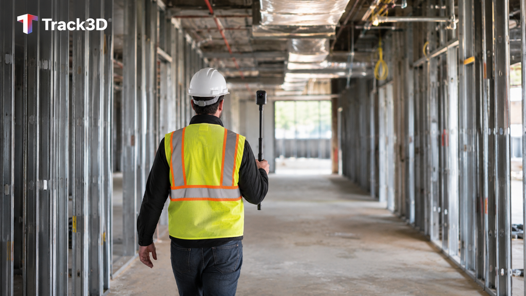
The LiDAR vs photogrammetry choice settles geometry questions, but weekly progress and records need a faster capture that repeats across every floor. A 360 video walk with the Track3D mobile app, recommended at about 30 minutes, records the whole area and processing takes about 24 hours. Captures are organized by location and date on the project’s floor plans, so the team can return to any room at any point in the schedule. Track3D also accepts laser scans (.las, .laz, .e57 or .ply) for point cloud review with notes, and flat drone images for measurements, Stockpile and Cut & Fill reports and design overlays, while progress comes from the 360 video walks.
See how Track3D uses 360 video, drone images and scans together.
Frequently Asked Questions
What is the difference between LiDAR and photogrammetry?
LiDAR measures distance directly by sending out laser pulses and timing the light reflected back. Photogrammetry calculates 3D positions from overlapping photos. LiDAR brings direct measurement and works in low light, while photogrammetry brings color, texture and a lower equipment cost.
Which is more accurate, LiDAR or photogrammetry?
It depends on the setup. The ASPRS Positional Accuracy Standards include separate best-practice addenda for mapping with lidar, with photogrammetry and with drones, and accuracy is tested against ground control and checkpoints for each dataset. Ask any provider for the stated accuracy of the deliverable and how it was checked.
Is LiDAR better than photogrammetry for construction?
Not across the board. LiDAR leads on structure, interiors and as-built records. Photogrammetry leads on site work, volumes and exterior overviews. The phase and the decision at hand pick the method.
Can you use LiDAR and photogrammetry together?
Yes. One practical pairing uses photogrammetry for site-wide context and LiDAR for the areas where measured geometry matters most. Laser scanners usually capture color through an integrated or externally mounted camera, according to the GSA guide, which adds a visual layer to the point cloud.
Which one is cheaper?
Photogrammetry usually costs less to start, because its equipment costs less than LiDAR. Total cost also depends on field time, processing, operator skill and how often a capture needs repeating. When weighing aerial photogrammetry vs LiDAR, compare the full cost of answering the question, not only the price of the equipment.