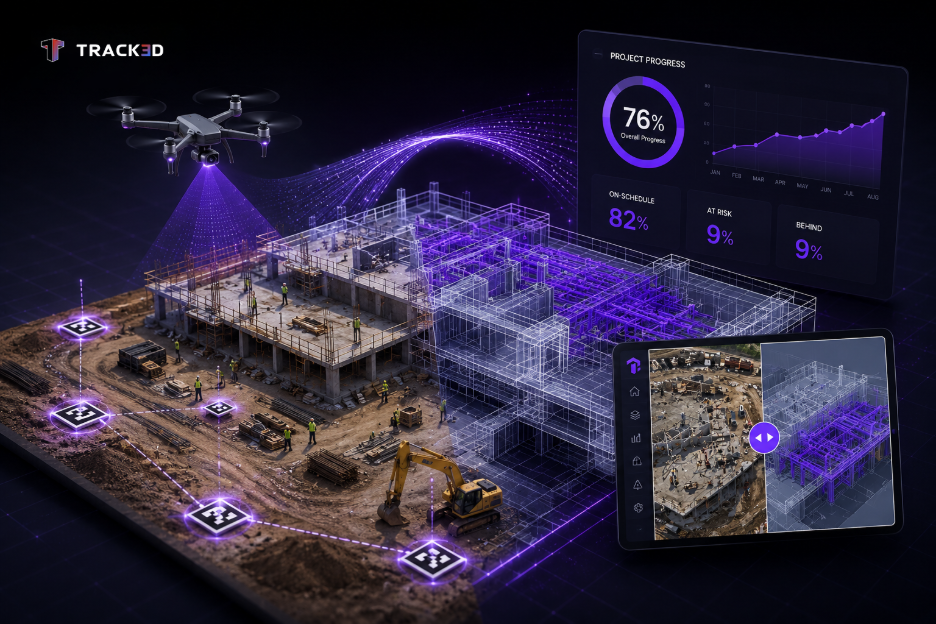
The number of construction teams moving to new tools like drone mapping is steadily increasing. However, drone mapping alone is not enough. What you need is an accurate report with little room for error. This is where GCPs come into the picture. Ground control oints are physical markers placed on the ground at specific locations whose GPS coordinates are precisely known. These help in creating maps that are geometrically correct and aligned to real-world coordinates.
In this guide, we learn more about ground control points, how they need to be set up, their benefits, and much more. Continue reading to find out more!
Key Takeaways
- Ground control points, or GCPs, are physical markers placed on the site that improve drone mapping accuracy from meter-level errors to centimeter-level precision.
- Accurate drone mapping supports dependable earthwork calculations, BIM coordination, and progress tracking.
- Well-distributed GCPs are more important than simply using a large number of them.
- Proper GCP setup, surveying, and tagging are essential for reliable maps and 3D models.
- RTK drones improve accuracy but still require checkpoints to verify survey results.
- High-quality site data becomes more valuable when paired with Reality Intelligence for faster, data-driven construction decisions.
What Are Ground Control Points?
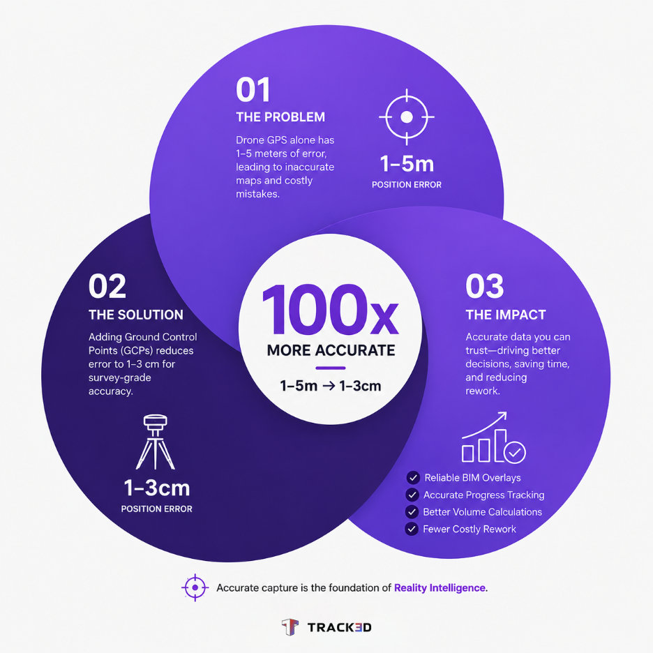
Ground control points (GCPs) are physical, GPS-surveyed markers placed on the ground at locations with known, precisely measured GPS coordinates before a drone flight. They anchor aerial imagery to real-world coordinates, reducing drone mapping errors from 1-5 meters down to 1-3 centimeters. Each GCP is surveyed using a Real-Time Kinematic (RTK) GPS receiver or total station, recording exact X (easting), Y (northing), and Z (elevation) values. Accurate ground control points are the difference between a rough estimate and survey-grade data.
When drone imagery is processed in photogrammetry software, the software uses these known GCP positions to georeference the full aerial dataset. The result is a map, orthomosaic, or 3D point cloud that is geometrically corrected and aligned to real-world coordinates. However, the real question is, how many GCPs do you need? According to the research study published in the ISPRS Journal of Photogrammetry and Remote Sensing, 5 well-distributed GCPs on a standard site are enough to reduce the absolute positional error in drone surveys from over 3 meters (GPS only) to under 5 centimeters.
Why Are Ground Control Points Important?
To understand why ground control points are so important, let’s consider what happens when they’re entirely ignored by construction teams. Firstly, consumer and commercial drone GPS receivers are not survey-grade, so they rely on standard GNSS signals that carry inherent positional uncertainty. On a calm and controlled flight with good satellite visibility, a drone’s onboard GPS typically achieves 1-3 meters of horizontal accuracy and 2-5 meters of vertical accuracy. This is adequate for photography, but not for measurements.
Secondly, this level of precision, while it may seem normal for a large construction site, can have real consequences that we tend to overlook. For instance:
- Earthwork calculations could go wrong: Even a minor 0.5-meter elevation error in a drone survey of a 10-acre grading site can disturb cut-and-fill volume estimates by thousands of cubic meters, implying that it doesn’t stay “minor” at all. This directly affects material costs and subcontractor payments.
- As-built comparisons become unreliable: If your drone survey does not align with your BIM coordinate system, overlaying both of them will not result in an accurate analysis. It’s only as good as any guesswork in this case.
- Progress data loses credibility: If the data captured isn’t accurate, teams can no longer rely on it to make decisions. Owners, project executives, and all stakeholders increasingly demand objective, measurable progress updates, which are only possible through precise mapping.
These are the scenarios that ground control points are aiming to resolve. GCPs introduce known anchor points that force the photogrammetry model to align with the real world. Thus, this advantage gives teams control over the data they capture and enables them to make accurate decisions.
How Many Ground Control Points Are Needed?
Before we jump into setting up GCPs, let’s first look at how many of them you need. The right number of drone ground control points depends on the construction site’s size, terrain, and accuracy standard you’re expecting to meet. Also, more is not always better here. Beyond a certain threshold, additional GCPs will only add field time without producing any meaningfully improved results. In the following table, we provide a reference of how you can set up GCPs:
| Site Size | Minimum GCPs | Notes |
| Under 2 acres | 5 | 4 corners + 1 center. |
| 2-10 acres | 8 to 12 | Even grid distribution. |
| 10-50 acres | 12 to 20 | 1 per 4 to 5 acres. |
| Over 50 acres | 1 per 3 to 5 acres | Add at all terrain breaks. |
| Complex terrain | Add 1 per elevation zone | Vertical accuracy drives this. |
As discussed above, according to a study by the American Society for Photogrammetry and Remote Sensing (ASPRS), 5 evenly distributed GCPs provide accuracy equivalent to 15 GCPs for a flat terrain under 10 acres. Similarly, 3 GCPs introduced doming artifacts (bulges or ridges) in vertical accuracy.
How to Set Up Ground Control Points for Drone Mapping

In this section, we look at setting up ground control points for drone mapping. Listed below are general steps that will apply to most construction sites. However, ensure that you adapt based on your site’s size, terrain complexity, and the photogrammetry software you’re using.
Step 1: Plan Your GCP Layout Before Arriving on the Site
Before you place any markers, review the entire site plan and determine where GCPs should go. Keep in mind that distribution matters more than the total number of points. You can proceed with a standard layout by placing one GCP at each corner of the survey area and one in the center. If there are significant elevation changes, add points at each terrain break.
One crucial thing to keep in mind is bowl distortion or doming. This is a phenomenon that occurs when too many GCPs are clustered in one region of the site. Concentrated points produce accurate results only in that cluster but distorted results at the edges. According to research by Pix4D, evenly distributed GCPs reduce vertical doming error by up to 80% as compared to a clustered layout of the same count.
Step 2: Place and Secure Physical GCP Markers
Once you’ve reviewed the site and finalized the locations of your markers, the next step is to place them. GCP targets are large, high-contrast markers, typically 30-60 centimeters wide, and must be clearly identifiable in drone imagery captured from an altitude. Most construction teams commonly choose pre-printed vinyl checkered targets, painted plywood boards, or surveyors’ fabric squares. Most importantly, the pattern should provide strong contrast with the surrounding ground surface.
Place these markers flat on the surface and secure them against any movement. If the target shifts between survey measurement and drone flight, it will introduce an error that cannot be corrected in post-processing.
Step 3: Survey Each GCP with RTK GPS or a Total Station
This is where you establish centimeter-level accuracy. Use an RTK GPS receiver connected to a base station or a Continuously Operating Reference Station (CORS) network, or use a total station tied to existing survey control points on the project. Record X, Y, and Z coordinates for each GCP in the project coordinate system (typically a state plane system or national grid like UTM). Confirm the datum and projection before starting.
Even a minor mismatch between your GCP coordinate file and the project’s reference system will shift the entire output map, regardless of how precisely the individual points were measured. Next, clearly label each GCP in your field notes so you can match them to the markers in your photos during post-processing.
Step 4: Fly the Drone with Adequate Image Overlap
GCPs can be correctly identified in the photogrammetry software only if they appear in multiple overlapping images. Thus, you must plan the drone flight for 75-80% frontal overlap and 60-70% side overlap as a baseline. This ensures each GCP marker appears in enough images for accurate tagging.
For better context, take into consideration the following metrics. Flight altitude typically ranges from 60 to 120 meters above ground level on construction sites, depending on the ground sampling distance (GSD) required. A 60-meter flight produces approximately 1.5-2 centimeters of pixel GSD using a standard 20-megapixel sensor, which is sufficient for most construction progress and volume work.
Step 5: Tag GCPs in Photogrammetry Software
After the flight, import your images and GCP coordinate file into your processing software and manually identify each marker in the photos. You can explore software options, like Pix4Dmapper, Agisoft Metashape, DJI Terra, and others. Each GCP should appear in at least 5 to 10 images for reliable tagging.
Another good approach is to designate some surveyed markers as checkpoints rather than GCPs. Checkpoints are not used by the software to correct the model, but they serve as independent verification points. If your checkpoints show errors below 3 centimeters, the survey result meets survey-grade accuracy standards.
Step 6: Review the Accuracy Report
Most importantly, do not skip the error report. Most photogrammetry software generates a report showing Root Mean Square (RMS) error values for each GCP and checkpoint. RMS errors below 3 centimeters horizontally and 5 centimeters vertically are generally accepted as survey-grade for construction applications. If the errors are higher, troubleshoot to check whether any GCP was tagged incorrectly, whether the coordinate file uses the correct datum, and whether the GCP markers were adequately secured before the flight.
Do RTK Drones Still Need Ground Control Points?
RTK and PPK-enabled drones have a significantly narrowed accuracy gap, but that does not automatically make GCPs obsolete. A well-calibrated RTK drone connected to a CORS network typically achieves 3 to 5 centimeter horizontal and 5 to 10 centimeter vertical accuracy without any GCPs. For many construction site documentation tasks, this level of accuracy is enough. However, using a few surveyed checkpoints alongside an RTK drone is still considered the best practice for two reasons, as follows.
Firstly, checkpoints independently verify that the RTK system performed correctly. Issues with base station connectivity or satellite geometry can degrade RTK accuracy without triggering an obvious warning. Secondly, most owners and courts expect verified accuracy for legally defensible as-built documentation or volume calculations, and not just manufacturer-specified accuracy.
Thus, the practical approach that you should employ is to use RTK for speed and efficiency on routine flights and still place 3 to 5 surveyed checkpoints to confirm the accuracy on every deliverable that carries financial or contractual weight.
Final Thoughts: From Accurate Drone Maps to Actionable Site Intelligence
In conclusion, it is absolutely crucial to ensure that drone mapping is accurate and precise with the least possible room for error. This sets up the construction workflow for producing reliable, measurable records of the site and geometrically correct and real-world-aligned models at any given moment. Thus, ground control points are the best tools that teams have to generate accurate drone maps, which ultimately become the foundation everything else depends on.
Once your foundation is solid, the next obvious question is, what do you do with the data? Because as construction becomes more digitized, teams must move from mere documentation to decision-making and understanding what the site looks like, not just capturing it. The captured data must be the grounds for schedule tracking, trade coordination, and project completion.
This is exactly where Track3D can help you out. The Reality Intelligence layer works on top of accurately captured site data, whether it’s from drones, 360 cameras, LiDAR, or a combination of sources. It automatically classifies installed elements by trade, compares current site conditions against BIM, and surfaces the areas where work is running outside of the schedule. Construction teams at Hensel Phelps were able to utilize Reality Intelligence in the best way possible. They reduced progress review time from 20 hours a week to under 1 hour using this approach on a complex airport project.
To find out more about how Reality Intelligence works, book a free demo with Track3D today and watch how it transforms the way your teams work!
Frequently Asked Questions
Q1. What are ground control points in drone mapping?
Ans: Ground control points are physical markers placed on the ground at locations with precisely known GPS coordinates. They are used in photogrammetry software to georeference drone imagery, correcting the positional error from the drone’s onboard GPS and producing maps accurate to within 1 to 3 centimeters.
Q2. How many ground control points do I need for a drone survey?
Ans: The number of GCPs is an important factor when placing them. However, it entirely depends on the site’s size, terrain complexity, etc. For reference, a minimum of 5 GCPs is recommended for sites under 2 acres: 4 at the corners and 1 at the center. Larger sites need roughly 1 GCP per 4 to 5 acres, with additional points at any significant elevation changes. In fact, distribution matters more than total count.
Q3. What is the difference between a GCP and a checkpoint in drone mapping?
Ans: A GCP and a checkpoint are both surveyed markers, but they serve different functions. GCPs are used by photogrammetry software to correct and align the 3D model. Checkpoints are reserved as independent verification markers to confirm how accurate the final output actually is.
Q4. Can I do drone mapping on a construction site without GCPs?
Ans: Yes, drone mapping is possible without GCPs. However, the output will carry 1 to 5 meters of absolute positional error with a standard GPS drone. For construction applications, like volume calculations, as-built verification, or BIM overlay, that error margin is typically not acceptable. Thus, GCPs or an RTK drone with verification checkpoints are required for accurate site measurement work.
Q5. What equipment do I need to survey drone GCPs?
Ans: To survey drone GCPs, you need a Real-Time Kinematic (RTK) GPS receiver connected to a base station or CORS network or a total station referenced to existing project benchmarks. The physical targets for GCPs can be pre-printed vinyl, painted plywood, or surveyors’ cloth, large enough (30 to 60 centimeters) to be clearly identified in drone imagery from operating altitude.
Q6. What is a CORS network in drone mapping?
Ans: A CORS network is a system of permanently installed GPS reference stations that provides real-time corrections to RTK drones and survey equipment, improving positioning from meters to centimeters. While it reduces the need for ground control points, most construction workflows still use a few surveyed checkpoints to verify final accuracy across volume calculations, BIM coordination, and as-built documentation.
Q7. Do RTK drones eliminate the need for ground control points?
Ans: RTK drones reduce but do not fully replace the value of GCPs. RTK systems achieve 3 to 5 centimeter accuracy under ideal conditions, but their overall performance depends on base station connectivity and satellite geometry. Using 3 to 5 surveyed checkpoints to independently verify RTK output is a great approach for any deliverable with financial or contractual significance.